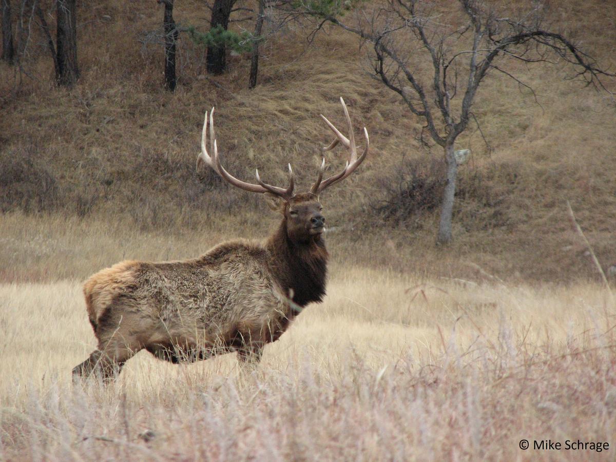
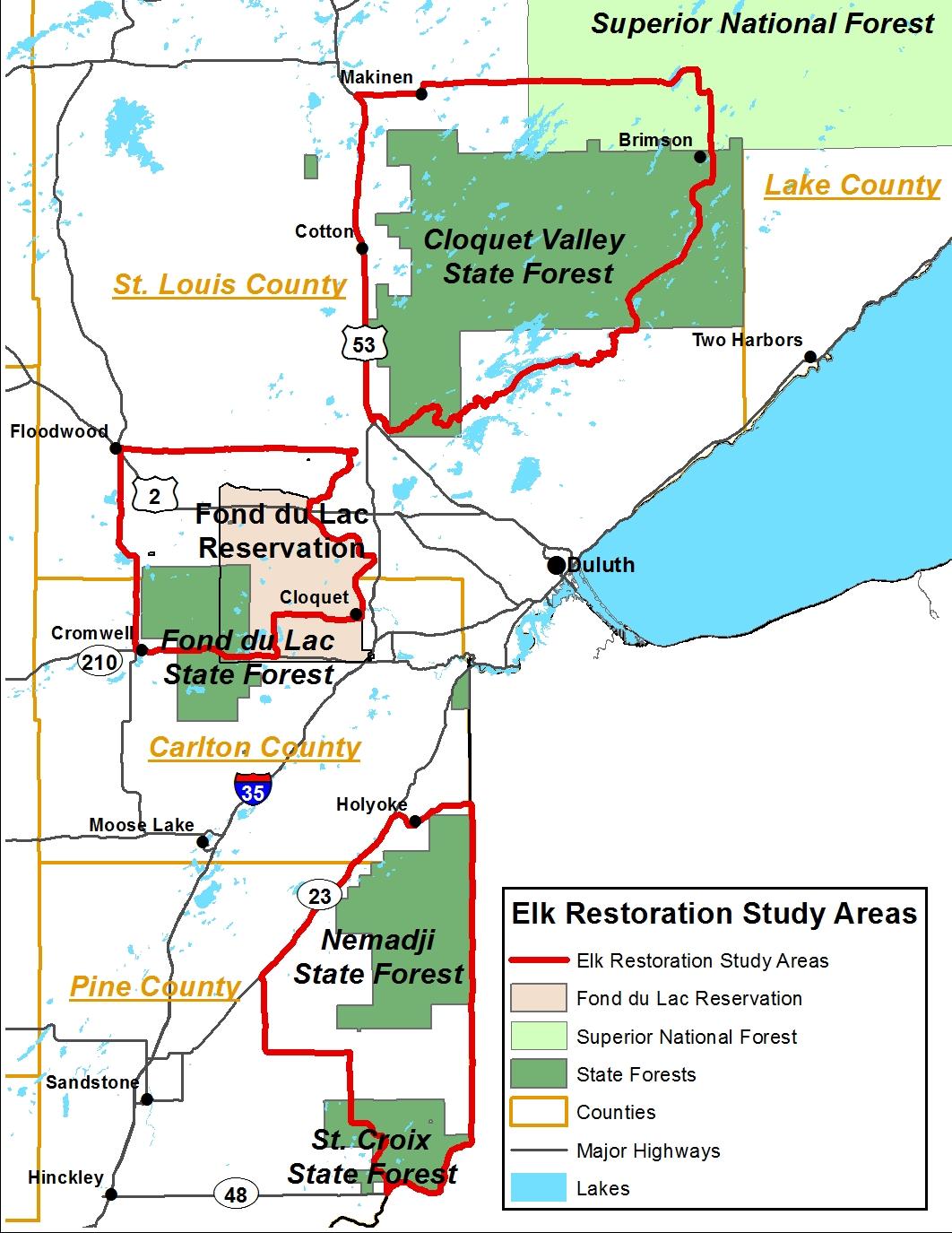
Whether a restored elk population will thrive at a given site will depend on a variety of factors. Here, we will focus our efforts on determining: 1) human land‐use patterns; 2) the distribution of current land‐cover types (including forest age structures and the specific agricultural uses); 3) expected future changes to land cover; 4) the diversity and abundance of forage within each cover type; and 5) locations of captive cervid operations. We will consider risk of agricultural damage and other potential human conflicts as well as expected elk movement patterns and population growth. Finally, we will use the existing 2013‐2014 MN land‐cover dataset to identify prospective sites; field surveys of forage availability will be conducted in all of these areas to estimate the distribution of food resources (both quality and amount) within each land‐cover type. We will combine these data with existing information on elk habitat use to develop a habitat suitability map and estimate the carrying capacity of potential relocation sites. This map will be integrated with the final product of the citizen survey to produce an elk suitability map for the region.
Compilation of existing spatial data: In Year 1, we will collect existing data about recent land use (e.g., locations of agriculture, timber harvest, and captive cervid operations) and land cover from state and county agencies. Future use of public lands will be considered by discussing forest management plans with agency representatives; when possible (i.e., where spatially explicit plans of timber harvest are available) we will include expected land‐cover change into our projections of suitability. Land cover will be validated in Years 2 and 3 by visiting 250 sites across the study area.
Forage availability: We will identify 120 sites distributed among the primary land‐cover types within the study area. During the summer of Year 2 (June‐August) we will visit each site to estimate plant species abundance and biomass for all functional groups (herbaceous plants, grasses, and low woody vegetation). For a subset of the sites we will collect and dry plant biomass to refine biomass allometric equations for the study area. The forage diversity and abundance estimates will be extrapolated across the study area, and these maps crossvalidated and then ground‐truthed by visiting 50 sites in the summer of Year 3.
Restoration Suitability: We will synthesize current and previous research on elk from Wisconsin, Ontario, Michigan, and western Minnesota to develop Habitat Suitability estimates for the study area. These data will consist of resource selection patterns and population growth rates through time. Based on our data that quantify the distribution of resources and previous research on elk physiology and behavior, we will develop approximate carrying capacities for a variety of potential release sites within the study area. We will combine the Ecological and Social maps to identify areas where restoration efforts are more likely to succeed. Our final feasibility report will summarize the strengths and weaknesses for different release sites with the goal to provide managers with the information they need to decide if an elk restoration is feasible, and if so where it will have the greatest likelihood of success in the study area.
Schedule
|
Outcome |
Completion Date |
|
1. Identify primary elk study areas using existing data. |
May 2017 |
|
2. Complete forage surveys (visit 120 sites distributed among primary land-cover types to estimate quality and abundance of common elk forage species). |
September 2017 |
|
3. Ground truth land-cover and forage availability maps (visit 250 sites to confirm cover types). |
August 2018 |
|
4. Complete ecological carrying capacity map and population estimation. |
December 2018 |
|
5. Complete final suitability map and feasibility report. |
June 2019 |